top of page
About Us
Academic Partnerships
Services
Architectural BIM Service
Our Projects
Projects By Students
Solutions
Forest
Professional Training
GIS Software Training
ArcGIS Pro & QGIS Intermediate Level
Master in Geospatial Analysis
Certified Geospatial Analyst Program
GIS Desktop Training with BIM
BIM Modeling and GIS Integration
GIS Development Training
Geospatial Analysis Using python
GIS Developer Training with Python-ArcPY
Python With ArcPy
Other Training Programs
Services for PhD & GIS Students
AGSRT @ COLLEGE
Faculty Development Program Level 1 GIS
GIS Academic Projects
Terms & Condition
Placement
Corporate Training
Utility Network Management (UNM)
All Posts
Job
Blog
Drone
Search
Transforming Public Health: How GIS Revolutionizes Healthcare Accessibility and Outbreak Management
Nithin B R
Dec 10, 2024
4 min read
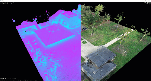
An In-Depth Guide to Point Cloud Data in GIS: Collection, Processing, and Applications
Satyaranjan Swain
Nov 9, 2024
4 min read
What is Geospatial Data? How it Shapes Our World
Satyaranjan Swain
Nov 8, 2024
7 min read
1
2
3
bottom of page
.png)